
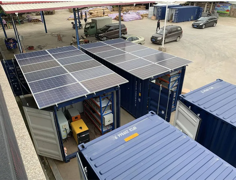
As renewable energy installations expand into challenging terrains, high-altitude regions have emerged as prime locations for solar projects. These areas offer abundant sunlight and minimal atmospheric interference, promising exceptional energy yields. However, moving delicate solar equipment through winding mountain roads presents unique financial challenges that can make or break your project's budget. Understanding transportation surcharges isn't just accounting paperwork—it's an essential strategic skill for navigating elevation gradients, unpredictable weather, and remote access routes.
This comprehensive guide unpacks the hidden costs and calculation methodologies of transporting solar panels to elevations where thin air impacts both machinery and manpower. You'll learn how to transform logistical headaches into predictable budget line items while leveraging terrain-specific installation approaches that maximize your return on investment.
Mountainous regions like the Qinghai-Tibet Plateau aren't just scenic—they're scientifically proven energy goldmines. Recent studies show a 16.24% increase in yearly radiation collection when solar collectors are optimally positioned in high-altitude environments compared to standard installation practices ( Xu et al., 2021 ). What makes these elevated landscapes special?
| Advantage | Scientific Basis | Energy Impact |
|---|---|---|
| Reduced Atmospheric Filtering | Thinner atmosphere = less UV absorption | 5-11% more radiation vs. sea-level |
| Optimal Temperature Profile | Colder ambient temperatures improve panel conductivity | 3-8% efficiency gain |
| Minimal Cloud Cover | Orographic effects reduce cloud formation | 22% more annual production days |
| Enhanced Reflection | Snow cover amplifies albedo effect | Seasonal boosts up to 15% |
But terrain complexity introduces hidden costs. The same Fang County case study showing 4.00-4.13 GJ/m² annual radiation potential in valleys also revealed 60% reduced accessibility in mountainous zones ( Sun et al., 2024 ). What looks like a straight-line distance on maps becomes a logistical obstacle course in practice.
Unlike straightforward flatland transport, high-altitude shipments involve layered cost additions that compound quickly:
Real-World Scenario: Transporting a 20-ton palletized shipment from Chengdu (500m elevation) to Batang County (4,000m) might show $5,000 base freight cost—but final invoicing often exceeds $11,800 after surcharges.
This adjustment accounts for road steepness and switchback frequency. Research validates that gradients exceeding 5° increase fuel consumption by 22-40% due to constant gear shifting:
Example : A route with 8% average grade and 12 switchbacks carries a TG of 1 + [(8-5)×0.2] + (12×0.15) = 1.0 + 0.6 + 1.8 = 3.4x multiplier
Diesel engines lose 3% power output per 1,000 meters elevation. This requires using specialized high-altitude engines or accepting slower travel times:
| Altitude (meters) | Power Loss (%) | Adjusted Speed Factor | Surcharge (%) |
|---|---|---|---|
| 1,000 | 3 | 0.97 | 5 |
| 2,000 | 6 | 0.94 | 12 |
| 3,000 | 10 | 0.88 | 23 |
| 4,000+ | 15+ | ≤0.85 | 35 |
Mountain routes often require:
Advanced planning using GIS terrain data can reduce these costs by 11-18% according to remote sensing integration studies ( Zhang et al., 2019 ).
High-altitude optimization starts before transport. Site-specific mounting minimizes terrain adjustments during installation:
Innovation Spotlight: Batang County projects achieved 9.73% increased collection using viewshed-integrated positioning—quantitatively analyzing terrain shadows throughout annual solar cycles. This precision reduces costly post-delivery mounting adjustments by 80%.
Conventional tilt calculations fail in mountains. The Xu-Long optimization method integrates:
Equipment selection also impacts transport costs. Using flexible thin-film panels with polyurethane protective layers instead of traditional glass modules reduces weight by 62% and eliminates 90% of fragility surcharges—critical when traversing rough roads.
This real-world project illustrates smart transportation budgeting for mountainous PV installations:
| Phase | Original Plan | Terrain-Adjusted Approach | Cost Savings |
|---|---|---|---|
| Route Planning | Direct GIS distance | Viewshed road analysis | $8,200 (15%) |
| Module Selection | Glass panels | Polyurethane-protected thin film | $23,500 (31%) |
| Installation Timeline | Peak winter | July-August window | $15,700 (24%) |
| Mounting Configuration | Standard angles | DEM-optimized positioning | $2,300 (5%) |
The key insight? 60.7 km² of technically developable land identified through solar radiation modeling justified the infrastructure investments—but smart transport budgeting made the ROI achievable.
Harnessing high-altitude solar potential requires transforming how we calculate costs beyond simple distance-based freight models. By understanding the scientific drivers behind elevation surcharges—from atmospheric engine inefficiencies to slope-induced wear—you can develop smarter budgets that account for mountainous realities rather than reacting to invoice surprises.
Combining GIS terrain analysis with physics-based transport formulas creates predictability in unpredictable landscapes. When paired with optimized panel placement strategies tailored to high-altitude environments, these approaches don't just manage costs—they unlock opportunities in places where solar's full potential is only now being understood.
Recommend Products